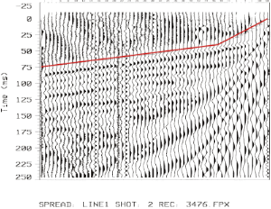
 Seismic Refraction (SR) is a surface geophysics method that utilizes the refraction of seismic waves on geology layers and rock/soil units to characterize subsurface geologic conditions. The method involves a geophysical principle governed by Snell’s Law, which is a formula used to describe the relationship between seismic wave angles of refraction when passing through a boundary between two different isotropic media, (e.g. soil to bedrock).
The Seismic Refraction method depends on the principal that seismic waves possess varying compression and shear wave velocities within differing types of soil and rock material. Acoustic energy waves are refracted when they cross over between soil and/or rocks of differing (and increasing) seismic velocities. Analysis of refracted wavelet arrival times, velocities, and geophone geometries can be used to estimate general soil types and approximate depths to strata boundaries, water tables and/or the upper bedrock surface to be determined. The SR method is also used to estimate rock rippability characteristics for pre-construction planning using Caterpillar seismic velocity soil/rock rippability charts.
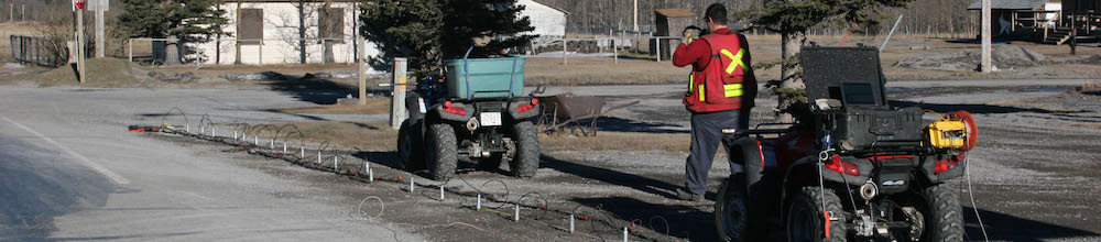
Seismic refraction surveys commonly involve laying out a spread of geophones in a straight line, with seismic impact source points positioned with and off the ends of the geophone spread.
For more information on SR please visit our equipment supplier page at: Geometrics Inc.

[x_callout type=”left” title=”Looking for a Solution?” message=”A comprehensive understanding of what lies beneath the surface within the confines of your project area matters. Encountering unforeseen subsurface features can be detrimental to your overall project budget and completion schedule.” button_text=”Contact Us Now” button_icon=”phone-square” href=”https://surfacesearch.com/contact-2/”]